|
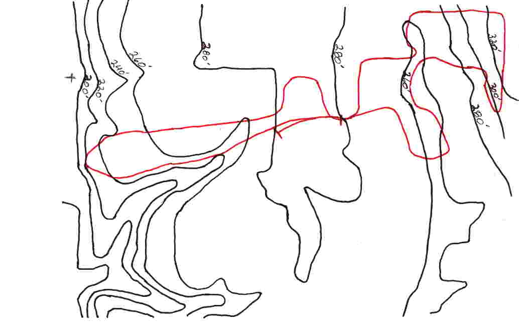
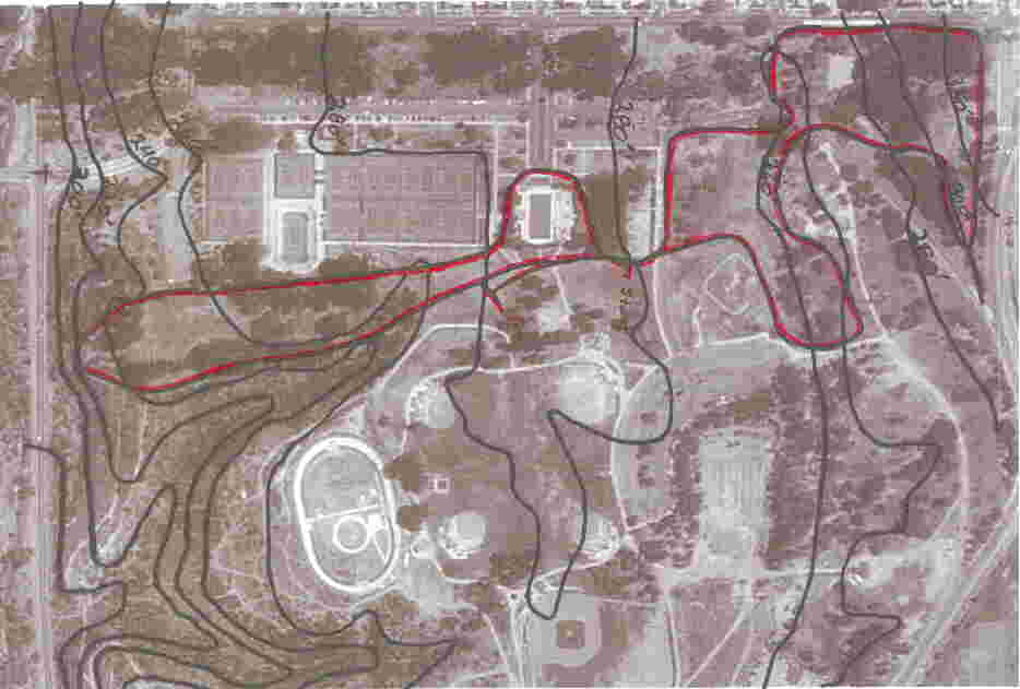
Morley Field - Balboa Park - Foot Locker Nationals Course - Dan Nelson - 1) Trace of Elevation Contours, 2) Overlay of aerial image of area |

|
|||||
|
|
||||
|
1) Trace of elevation contours of Morley Field course
Morley Field Countours in Elevation (start at 280 feet elevation, dropping to 200 feet by the end of the first 440 at the west end of the course, gradually working back up to the 280 foot elevation as one works up to the starting area. a drop to 200 feet during the picnic loop that takes you to the mile mark, with a 60 foot rise (from 260 to 320 feet by the top of the hill), with a rise back to the starting area from the base of the downhill. That loop is repeated, with a run-in from the starting line (2 x 1.5 mile loops) to the finish line, some 188 yards past the start second time through 2) Overlay of Aerial image of area with course in red
Aeriel shot of the Morley field course area with the course outlined in red - now troops - Go to it!!!
|
|
Editors: Doug
Speck and Rich Gonzalez �2002 by DyeStat |